Greece is a peninsular country located in Southern- Eastern Europe and has a surface of 128 900 km2. Thanks to its numerous islands it has the largest coastline in Europe. Greece has 2000 islands but only 170 are inhabited.
The country is washed by the Aegean sea to the east, Ionian to the west and to the south by the Mediterranean.
Greece has 10,7 million people.
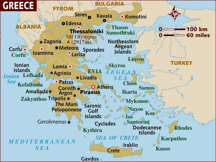
Two thirds of the country are covered by the mountains. The highest mountain is Mount Olympus with an altitude of 2917m.
Greek Regions:
Attica
Prefecture of Attica is the center of Greece where is also the capital of the country, Athens. It’s the biggest administrative region. The most southern part of Attica is where Mount Sounion is, on top of which an ancient temple dedicated to Poseidon is built. On the Western side Attica is divided by Pelopenese with the Corinth Canal. Attica also includes several islands like: Aegina, Hydra, Poros, Spetses, Kythira, Antikythera and Salamis islands.
Central Macedonia
Central Macedonia is the second most populous region of the country. It is divided into 7 different regional units with its capital Thessaloniki.
Thessaly
It’s the third most populated Greek region.It is split into five regional units. It is surrounded by the Aegean Sea, Epirus, Central Greece and Macedonia.
Western Greece
Western Greece is split into three regional units: Elis, Achaea and Aetolia- Acamania.
Greek islands
There are more than 2000 islands in Greece scattered all over Aegean and Ionian sea. Most of them are located in the Aegean sea between the mainland and Turkey. The biggest Greek island is Crete, second biggest is Evia. Some of the most popular islands are Santorini, Mykonos, Corfu and Rhodes.